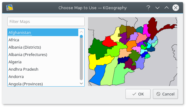
When you run KGeography for the first time, it first asks you to choose a map to start with.
Tip
You can filter the map list using Filter Maps text field. Just enter a few first letters of the map name to narrow down the list to a few matches.
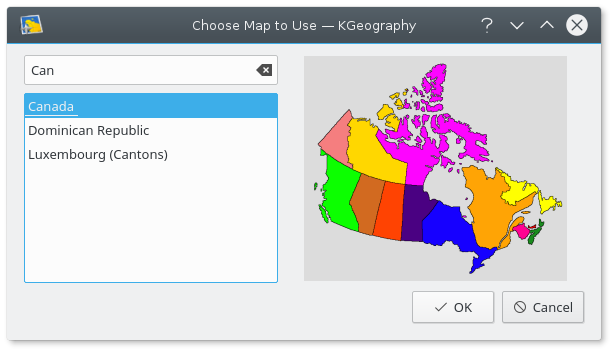
Here we choose Canada
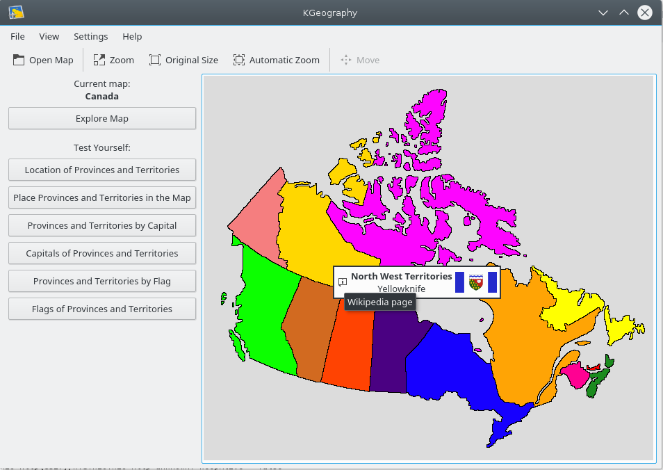
And KGeography main window appears with the map of Canada:
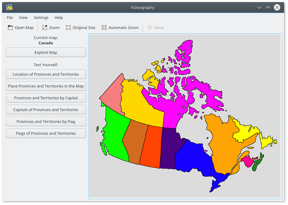
You can then choose what type of learning or testing you want to do by looking at the menu on the left:

Explore Map: a mouse button click on an area of the map will display information about that area, if you click on the small  Info icon on the popmap, it will open the wikipedia page for that division in the system's default browser:
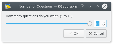
Location of Provinces or Territories: you are first asked how many questions you want.
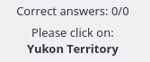
Then you are asked to click on a specific province:
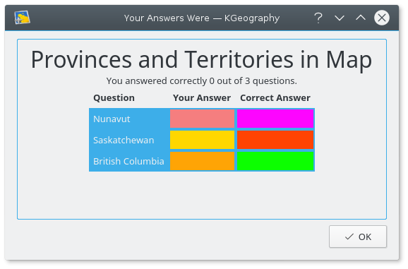
When you finish all the questions, a result dialog is shown with your correct and uncorrect answers:
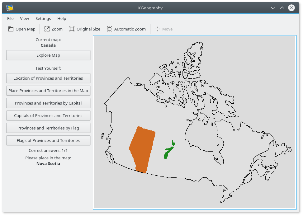
Place Provinces or Territories in the Map: the cursor takes the shape of a province and you have to place it in the map:
Provinces or Territories by Capital: you are asked to find the name of a province among a choice of 4 given its capital:
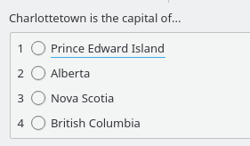
And the results are displayed when the test is finished:

Capitals of Provinces and Territories: you have a capital and four province names and you must choose the correct one. As before, at the end a result dialog is shown.
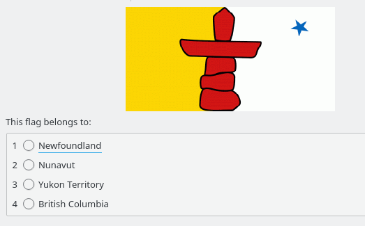
Provinces or Territories by Flag: a flag is shown and you must find the province it belongs to.
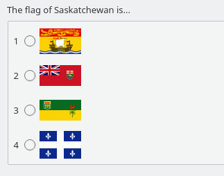
Flags of Provinces and Territories: a province name is given and you must find the correct flag among four.